
High Accuracy GNSS Receiver
- SXblue - Platinum
- Atlas Worldwide Corrections - L-Band
- RTK Corrections - 1 cm accuracy
The Ultimate Survey Grade GNSS Receiver Designed for GIS

Application
- GPS, GLONASS, Galileo, BeiDou, QZSS and SBAS
- Multi-frequency L1-L2-L5.
- Bluetooth connectivity compatible with all devices
- 1 cm RTK accuracy, long-range RTK baseline with fast acquisition times.
- aRTK™ and Tracer™ provide positioning sustainability when RTK correction fails.
- Atlas™ Global satellite correction service.
New battery delivers 14-16 hours autonomy!
SXblue is pleased to announce a battery upgrade for its receivers. For the last couple of years we have been collecting our clients’ feedback and working on a new, state-of-the-art battery design. The new battery is equipped with 4 Li-ion rechargeable cells that boost its capacity from 3900 mAh to 6000 mAh. It boosts the receiver’s autonomy by up to 50%, greatly increasing its field work efficiency. When fully charged, the battery can last up to 16 hours depending on the SXblue model and bluetooth connectivity.
features
Powered by its 372 channels, the SXblue Platinum uses all-in-view constellations with multi-frequency and it offers the ability to use a global or local coverage of corrections (SBAS, L-Band and RTK).
The new receiver is the same, compact, lightweight, palm-sized unit as the SXblue product series, which is completely dustproof and ruggedized. The internal, rechargeable, field replaceable Li-Ion battery has on-board LEDs for easy access battery information.
With the scalable SXblue Platinum Basic, the user can activate at anytime any frequency, constellation or RTK after its initial purchase. The receiver is also field upgradable which, means that you can activate these options remotely at your convenience.
Atlas delivers its correction signals via L-band from meter to subdecimeters levels ensuring the best available vertical and horizontal accuracy.
With a wide variety of compatible software and smart devices, our team can help you choose the perfect solution for your applications such as agriculture, engineering, mining, utilities, surveying, GIS...
Some of the many compatible softwares such as ESRI Collector, ArcPad, Fulcrum, TerraGo Edge, and MicroSurvey FieldGenius and many others.
SXblue ToolBox (Google Play) and iSXBlue RTN (App Store) are free application for NTRIP/DIP configuration.


| Receiver | |
| Type | GNSS multi-frequency RTK with carrier phase |
| Signal | GPS - L1CA, L1P, L1C, L2P, L2C, L5 GLONASS - G1, G2, P1, P2 BeiDou - B1, B2 Galileo - E1BC, E5a, E5b QZSS - L1CA, L2C, L5, L1C |
| Channels | 372 |
| SBAS | 3 satellites parallel tracking WAAS/EGNOS/MSAS/GAGAN |
| RTK Accuracy | 8 mm + 1 ppm (RMS) Horizontal |
| SBAS Accuracy | < 30 cm HRMS1 |
| Autonomous Accuracy | 1.2 m HRMS1 |
| Cold start | < 60 sec (typical no almanac or RTC) |
| Reacquisition | < 1 sec |
| Max speed | 1,850 kph (999 knots) |
| Max altitude | 18,288 m (60,000 ft) |
| Differential options | SBAS Autonomous, External RTCM, RTK, L-Band (Atlas) DGPS |
| Power | |
| Battery type | Field replaceable, rechargeable Lithium-Ion pack (Rechargeable inside unit or separately) |
| Battery life | + 14 hours 2 Bluetooth / GNSS Tracking3 |
| Charging time | 6 hours using supplied charger |
| Environmental | |
| Operating Temperature | -40 °C à +85 °C (-40 °F à +185 °F) |
| Storage Temperature | -40 °C à +85 °C (-40 °F à +185 °F) |
| Humidity | 95 % non-condensing |
| Compliance | FCC, CE, RoHS and Lead-free |
| Communication | |
| Ports | Bluetooth 2.0, RS-232C, USB 2.0 |
| Bluetooth | Class 1 (Typical range of 250 m)2 |
| Baud rates | 4,800 - 115,200 |
| Data I/O formats | NMEA 0183, Binary |
| Timing Output | Free option, available on request |
| Event Marker Input | Free option, available on request |
| Raw Measurement Data | Binary (Free RINEX utility) |
| Correction I/O Protocol | RTCM 2.3, RTCM 3.2, CMR, CMR+, ROX Format |
| LED mode indicators | Power, GNSS lock, DGPS position, DIFF lock, Bluetooth connection |
| LED battery indicators | 5 LED |
| Mechanical | |
| Enclosure material | Re-enforced Nylon |
| Enclosure rating | Waterproof, dustproof, IP65 |
| Battery case material | ABS |
| Dimensions | 14.1 cm x 8.0 cm x 4.7 cm (5.57” x 3.15” x 1.85”) |
| Weight | 481 g (1.06 lbs) |
| Data Connectors | DB-9 female, USB Type B female |
| Antenna connector | SMA female |
| GNSS Antenna | |
| GNSS Freq Range | L-Band, GPS L1 : 1.525 – 1.610 MHz; GPS L2 : 1.217 – 1.260 MHz |
| Impedance | 50 Ohms |
| Gain | 28 dB ± 2 dB |
| Noise Figure | 2.5 dB |
| Voltage/Current | +4.5 to +5.5 VDC |
| Connector | SMA female |
| Dimensions (H x D) | 26.6 mm x 66.3 mm (0.86 in x 2.6 in) |
| Weight | 125 g (0.363 lb) |
| Temperature | -55°C à +70°C (-67°F à +158°F) |
| Humidity | Waterproof |
NOTES :
1 Depends on multipath environment, number of satellites in view, satellite geometry, baseline length (for local services) and ionospheric activities. Stated accuracies for baseline lengths of up to 50 km.
2 Transmission in free space.
3 Lithium-ion battery performance degrades below -20 °C (-4 °F)

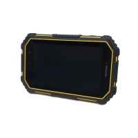
7" Rugged Tablet
- SXblue - SXTab 7A

8'' Rugged Tablet
- SXblue - SXTab 8W

10" Rugged Tablet
- SXblue - SXtab 10W

Rugged Data Collector
- SXblue - SXPad 200

SXblue Battery
- - iSXBlue
7" Rugged Tablet
- SXblue - SXTab 7A
8'' Rugged Tablet
- SXblue - SXTab 8W
10" Rugged Tablet
- SXblue - SXtab 10W
Rugged Data Collector
- SXblue - SXPad 200
SXblue Battery
- - iSXBlue
Related
7" Rugged Tablet
- SXblue - SXTab 7A
8'' Rugged Tablet
- SXblue - SXTab 8W
10" Rugged Tablet
- SXblue - SXtab 10W
Rugged Data Collector
- SXblue - SXPad 200
SXblue Battery
- - iSXBlue
Can we help you?
min 10 ch