


The SXblue GLOBE offers new GNSS performances for all GIS and Survey field operations
The SXblue GLOBE now offers all professionals a proven solution with highest performance and efficiency, even in the toughest field conditions.
Powered by a new GNSS engine with 448 channels, the SXblue GLOBE uses all in-view constellations with multi-frequency signals and offers the ability to use global or local coverage of correction services (SBAS and RTK). With a web-based software utility, the configuration is easier on all platforms: iOS, Windows or Android. Running advanced interference and multipath mitigation technologies, all field operations will benefit from this updated solution on most mobile GIS and Survey applications.
Some improved performances include patented technologies
- Anti-jamming and interference monitoring system
- Innovative scintillation mitigation
- Multipath estimator for code and phase multipath mitigation
- RAIM (Receiver Autonomous Integrity Monitoring)
- Higher tracking ruggedness under heavy mechanical shocks or vibrations
KEY FEATURES
- High performance tracking with all in-view constellations
- Multi-frequency satellite signals
- 0.6cm RTK accuracy
- Multiple functionalities on WIFI, e.g.: NMEA, Processing RTK connections, up to 100Hz
- Configure NTRIP over the Wi-Fi network using the web interface
- Ultra-low power consumption
- >12-hour battery life with Bluetooth, GNSS, and RTK activated
- iOS, Android and Windows compatible
| SXblue GLOBE RECEIVER | ||
| Channels | 4481 | |
| GPS | L1C/A, L1C, L1PY, L2C, L2P, L5 | |
| GLONASS | L1CA, L2CA, L2P, L3 CDMA | |
| Beidou | B1I, B1C, B2a, B2I, B3 | |
| Galileo | E1, E5a, E5b, E5 AltBoc, E6 | |
| QZSS | L1C/A, L1C, L2C, L5, L6 | |
| Navic | L5 | |
| SBAS | EGNOS, WAAS, GAGAN, MSAS, SDCM (L1, L5) | |
| 4-constellation RTK (base and rover) | ||
| RAIM (Receiver Autonomous Integrity Monitoring) | ||
| PERFORMANCE | ||
| Positioning Mode Accuracy | Horizontal | Vertical |
| Standalone3,4 | 1.2 m | 1.9 m |
| SBAS3,4 | 0.6 m | 0.8 m |
| DGNSS3,4 | 0.4 m | 0.7 m |
| RTK3,4 | 0.6 cm + 0.5 ppm | 1 cm + 1 ppm |
| SECORX (PPP)2,5 | 0.04 m | 0.06 m |
| Velocity accuracy | 3 cm/s | |
| RTK Initialization time | 7 s3,4 | |
| Update rate | max 100 Hz | |
| Latency6 | < 10 ms | |
| Timing xPPS output | 5 ns | |
| Event accuracy | < 20 ns | |
| Cold start | < 45 s | |
| Warm start | < 20 s | |
| Re-acquisition | 1 s | |
| ANTENNE (GNSS & RTK) | ||
| Frequency Range | L1 : 1.525 - 1.606 MHz; L2/L5 : 1 164 MHz - 1 254 MHz | |
| Gain | 32 dB ± 3 dB | |
| Dimensions | 69 mm x 22 mm ( 2.72" x 0.9" ) | |
| COMMUNICATION | ||
| Ports | Bluetooth 2.0, RS-232C, USB 2.0 | |
| Bluetooth transmission | Class 1 (Long range) | |
| Bluetooth pre-qualified | Bluetooth 2.1 + EDR, Apple-approved, authenticated | |
| Data I/O formats | NMEA 0183 v2.3, v3.01, v4.0, Binary (SBF),RINEX v2.x, 3.x | |
| Correction I/O Protocol | RTCM 2.x, RTCM 3.x, CMR v2.0 and, CMR+ | |
| LED mode indicators | Power, GNSS lock, DGPS position, DIFF lock, Bluetooth connection | |
| LED battery indicators | 5-LED bar graph | |
| POWER | ||
| Battery type | Field replaceable, Lithium-Ion pack (Rechargeable inside unit or separately) | |
| Battery capacity | 6 000 mAh, 7.2V | |
| Battery life | >12 hours using GNSS/RTK and Bluetooth | |
| Charging time | 6 hours using supplied charger | |
| MECHANICAL | ||
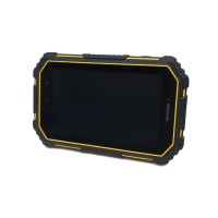
| Enclosure material | Re-enforced Nylon | |
| Enclosure rating | Waterproof, dustproof, IP65 | |
| Battery case material | ABS | |
| Dimensions | 14.1 cm x 8.0 cm x 4.7 cm (5.57” x 3.15” x 1.85”) | |
| Weight | 481 g (1.06 lbs) | |
| Data Connectors | DB-9 female, USB Type B female | |
| Antenna connector | SMA female | |
| Drop resistance | Designed to withstand 1 m drop | |
| ENVIRONMENTAL | ||
| Operating Temperature | - 40 °C to + 85 °C (- 40 °F to +185 °F) | |
| Storage Temperature | - 55 °C to + 85 °C (- 67 °F to +185 °F) | |
| Humidity | 95% non-condensing | |
| Compliance | FCC, CE, RoHS, WEEE and Lead-free | |
- Configuration dependent
- Service subscription required
- Open sky conditions
- RMS levels
- After convergence
- 99,9 %
Do you have a question?
min 10 ch